International airport(s) Marshall Islands International Airport, Majuro; the Bucholz Army Airfield, Kwajalein
Official language(s) Marshallese, English
Currency United States dollar (USD)
Time UTC +12
Region Pacific
GeographyClimateEconomyCulture
The Marshall Islands are situated approximately between the Philippines and Hawaii. More than 1 200 islands and islets in two parallel chains of coral atolls constitute the country: the Ralik, to the west and the Ratak to the east. The chains lie about 200 km apart and extend some 1 287 km northwest to southeast. Most of the atolls consists of irregular, oval‐shaped coral reefs surrounding a lagoon; the islets lie along the coral reef. The islands and islets of the Ratak chain tend to be more heavily wooded than those of the Ralik. The main vegetation consists of coconut and pandanus palms and breadfruit trees. Soils are generally sandy and of poor quality. Several of the northern atolls are uninhabited owing to insufficient rainfall.
The climate is tropical. The average temperature is very stable, with a monthly average of 28 °C through the year. Average annual rainfall in the Marshall Islands is below 2 800 mm and varies from 500 to 800 mm in the north, to 4 000 mm in the southern atolls. September, October and November tend to be the most humid months with a rainfall of more than 280 mm per month, while a drier season occurs between December and April. -— – ‒ - – —--— – ‒ - – —--— – ‒ - – —--— – ‒ - – —- Many pacific typhoons begin as tropical storms in the Marshall Islands region and grow stronger as they move west toward the Mariana Islands and the Philippines.
Main activities in the islands include agriculture, fishing, shipping, tourism and farming. The Marshall Islands is among the three leading countries in foreign ship registrations after Panama and Liberia, making ship registration, along with fishing license fees, an important source of revenues. Pig and poultry farming are important agricultural activities, as are the major food crops: coconut, pandanus, breadfruit and taro. Copra is the chief source of income for the outer islands. Key export destinations include Poland, Denmark, Republic of Korea, Indonesia and Cyprus. The country is dependent on imported food, machinery and transport equipment, manufactured goods and fuels; primarily from the United States of America, Japan and Australia. Remittances are important, accounting for almost 15 per cent of GDP -— – ‒ - – —--— – ‒ - – —--— – ‒ - – —--— – ‒ - – —-. In 2018, inbound tourism expenditure reached almost 10 per cent over GDP. EVI of the Marshall Islands is the second highest among the SIDS and in the world -— – ‒ - – —--— – ‒ - – —--— – ‒ - – —--— – ‒ - – —-.
Extended families and clan systems are common on the islands. Marshallese society is matrilineal where land is passed down from generation to generation through the mother.
Local food specialties include breadfruit, coconut, bananas, papaya, seafood, pandanus and bwiro. Food preservation has been a historic part of Marshallese culture and continues to be practiced today.
Throughout the years of the Trust Territory of the Pacific Islands, United Nations day was an important holiday, but that has now been replaced by Marshall Islands Independence Day. Other important celebrations commemorate the end of suffering during World War II and Kurijmoj (Christmas), a ritual event of up to four months in duration, celebrated by all (not only church members).
The most popular sports in the Marshall Islands are softball and baseball. Both sports are growing at a fast pace. The Marshall Islands achieved a silver medal in men's 200 m and two bronze medals in women's 100 m and 200 m in the Micronesian Games in 2014.
Land areakm2
Arable land%
Forest area%
Coastline lengthkm
Exclusive economic zonekm2
Nearest neighbourkm
Economic trendsMaritime transportPopulationInternational tradeEnvironmentInformation and communications technology
Gross domestic product US dollars at constant prices (2015) in millions
GDP per capita
2019
US$
Productive Capacity Index
2018
Economic and environmental vulnerability index
2019
Consumer Price Index growth
2019
%
Unemployment rate
Total % Female %, Male %
Main economic sectors, 2019 Percentage of GDP
Tourist arrivals Thousands of tourists, percentage of GDP
External financial resources Percentage of GDP
Public debt as % of GDP
2018
%
Fleet size Number of ships
Ship type
2011
2019
Total fleet
1 407
1 407
Oil tankers
264
266
Bulk carriers
311
333
General cargo
161
77
Container ships
52
49
Other types of ships
619
682
Port performance Ranked by 2019 data within SIDS group
Indicators
2019
SIDS Ranking
Number of port calls
101
32
Median time in port (days)
1
8
Average age of vessels
15
21
Average size (GT) of vessels
11 556
22
Container port throuput
2019
TEU
Bilateral connectivity index, 2019 Top 5 partners
Liner shipping connectivity index Maximum China Q1 2006=100
Total population Thousands of people, share of urban population
Population development indicators
Indicators
Period
Value
Poverty headcount (% of population)
..
..
Human development index
2018
0.7
Human assets index
2020
79
Adult literacy rate (15+ years, both sexes %)
..
..
Gender inequality index
2010
0.6
Life expectancy at birth
years
Population density
2019
persons per km2
Dependency ratio
2019
Child: Old-age:
Age structure by gender, 2019 Percentage of total population
Merchandise and services trade US dollars in millions
Indicators
2005
2010
2015
2019
2019 (% of GDP)
Merchandise exports
25
32
52
55
23.2
Merchandise imports
94
150
108
68
28.6
Services exports
0
0
0
0
0
Services imports
0
0
0
0
0
Trade openness Goods and services
% of GDP
Export concentration index
2019
Food import dependency Average 2015-2019
Top 5 partners in merchandise trade, 2019 Exports in millions US dollars
Merchandise exports by product group, 2019
Services exports by category, 2019
CO2 emissions per capita Kg per capita
CO2 emissions per GDP Kg per 2010 US$ of GDP
Renewable energy share in total energy consumption, 2017 Percentage of total energy consumption
Material footprint per capita
2016
kg
Terrestrial protected area
2018
%
Marine protected area
2018
%
Disasters indicators
Data not available
Trade in ICT goods
Exports: % Imports: %
Trade in ICT services
Exports: % Imports: %
Share of internet users
%
Fixed broadband vs Mobile broadband subscriptions Number of subscriptions per 100 people
Lorem ipsum dolor sit amet, consectetur adipiscing elit. Donec tincidunt vel mauris a dignissim. Curabitur sodales nunc id vestibulum tempor. Nunc tortor orci, sodales nec eros eget.
Lorem ipsum dolor sit amet, consectetur adipiscing elit. Donec tincidunt vel mauris a dignissim. Curabitur sodales nunc id vestibulum tempor. Nunc tortor orci, sodales nec eros eget.
Lorem ipsum dolor sit amet, consectetur adipiscing elit. Donec tincidunt vel mauris a dignissim. Curabitur sodales nunc id vestibulum tempor. Nunc tortor orci, sodales nec eros eget.
Lorem ipsum dolor sit amet, consectetur adipiscing elit. Donec tincidunt vel mauris a dignissim. Curabitur sodales nunc id vestibulum tempor. Nunc tortor orci, sodales nec eros eget.
Lorem ipsum dolor sit amet, consectetur adipiscing elit. Donec tincidunt vel mauris a dignissim. Curabitur sodales nunc id vestibulum tempor. Nunc tortor orci, sodales nec eros eget.

 km2
km2 %
% %
% km
km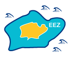 km2
km2 km
km


 Total %


 persons per km2
 Child:


 Exports: %
 Exports: %