International airport(s) Prince Said Ibrahim International Airport, Moroni
Official language(s) French, Arabic, Comorian
Currency Comorian Franc
Time UTC +3
Region Atlantic and Indian Ocean
GeographyClimateEconomyCulture
Named after the Arabic word for 'moon', Qamar, the Comoros islands are an archipelago of volcanic islands in the Indian Ocean located off Africa's east coast and south of the Equator. Comoros is located on the Somali plate. They are also known as the 'perfumed islands', owing to fragrant plants, such as, frangipani, jasmine and lemongrass. The country consists of three main islands surrounded by coral reefs. The islands are Grande Comore, Mohéli and Anjouan, and the largest island (Grande Comore), is dominated by Karthala, a towering 2 360 m high volcano whose summit is almost constantly smothered in equatorial cloud. In April 2005, the volcano began spewing ash and gas, forcing as many as 10 000 people to flee.
The Comoro Islands have a humid, tropical climate. Monthly average temperatures range from 24 to 27 °C and the annual rainfall is around 1 600 mm, with the wettest time of the year lasting from January to March. The rainfall varies between the three islands due to differences in altitude and winds. During the humid rainy season, especially between January to April, tropical cyclones are a risk. -— – ‒ - – —--— – ‒ - – —--— – ‒ - – —--— – ‒ - – —- The islands are also prone to heavy rains and flash floods. The islands are cooled by south‐easterly trade winds during the dry season.
Subsistence farming and fishing are the main source of employment, partly due to low educational levels. Agriculture also accounts for almost one third of GDP in Comoros. Comoros is the world's principal producer of ylang‐ylang essence, extracted from flowers of a tree. Export income is heavily reliant on ylang‐ylang and two other main crops: vanilla and cloves, and remains vulnerable to extreme weather. Important export partners include India, France and Germany -— – ‒ - – —--— – ‒ - – —--— – ‒ - – —--— – ‒ - – —-. Deforestation has also negatively affected ground water supply on the islands. Several rivers have disappeared and many remaining rivers run dry during the dry season. In Grande Comore, 60 per cent of the population relies on uncovered water containers and 40 per cent on coastal aquifers. The Comoros imports roughly 70 per cent of the food it consumes.
The Comoros is experiencing some exodus of educated and skilled workers. GDP per capita has been growing only moderately in recent years, after many years of decline in the early 2000s. The capital, Moroni, located on the island of Grande Comore (N'gazidja), has most of the modern commercial and manufacturing facilities located in the country. With miles of beautiful beaches, tourists are drawn to Comoros. Inbound tourism expenditure over GDP has been growing in recent years and was at 6 per cent in 2019. Incorrect syntax for items
The Comoros' culture has been influenced by Islamic tradition, mixed with French and African elements. Traditionally, people believed in spirits and the power of djinn, which is derived from African, Arab and Madagascan traditions.
Local artisans are skilled in sculpture, pottery, embroidery and basketry. Diversity is also evident in the many prevalent languages used on the islands, including French, Comorian, Arabic and Swahili.
Customary celebrations in the Comoros often feature dancing, music and the re‐creation of popular and important literary texts, including war epics and tales about the foundations of different villages. Embroidered ceremonial coats and Islamic bonnets are frequently donned. Jewelry is also widely produced and sold.
Land areakm2
Arable land%
Forest area%
Coastline lengthkm
Exclusive economic zonekm2
Nearest neighbourkm
Economic trendsMaritime transportPopulationInternational tradeEnvironmentInformation and communications technology
Gross domestic product US dollars at constant prices (2015) in millions
GDP per capita
2019
US$
Productive Capacity Index
2018
Economic and environmental vulnerability index
2019
Consumer Price Index growth
2019
%
Unemployment rate
Total % Female %, Male %
Main economic sectors, 2019 Percentage of GDP
Tourist arrivals Thousands of tourists, percentage of GDP
External financial resources Percentage of GDP
Public debt as % of GDP
2018
%
Fleet size Number of ships
Ship type
2011
2019
Total fleet
1 407
1 407
Oil tankers
264
266
Bulk carriers
311
333
General cargo
161
77
Container ships
52
49
Other types of ships
619
682
Port performance Ranked by 2019 data within SIDS group
Indicators
2019
SIDS Ranking
Number of port calls
197
27
Median time in port (days)
1
8
Average age of vessels
15
21
Average size (GT) of vessels
6 352
30
Container port throuput
2019
TEU
Bilateral connectivity index, 2019 Top 5 partners
Liner shipping connectivity index Maximum China Q1 2006=100
Total population Thousands of people, share of urban population
Population development indicators
Indicators
Period
Value
Poverty headcount (% of population)
2014
19.1
Human development index
2018
0.5
Human assets index
2020
64
Adult literacy rate (15+ years, both sexes %)
..
..
Gender inequality index
..
..
Life expectancy at birth
years
Population density
2019
persons per km2
Dependency ratio
2019
Child: Old-age:
Age structure by gender, 2019 Percentage of total population
Merchandise and services trade US dollars in millions
Indicators
2005
2010
2015
2019
2019 (% of GDP)
Merchandise exports
12
21
17
39
3.3
Merchandise imports
99
233
214
230
19.7
Services exports
43
65
80
0
0
Services imports
46
94
82
0
0
Trade openness Goods and services
% of GDP
Export concentration index
2019
Food import dependency Average 2015-2019
Top 5 partners in merchandise trade, 2019 Exports in millions US dollars
Merchandise exports by product group, 2019
Services exports by category, 2019
CO2 emissions per capita Kg per capita
CO2 emissions per GDP Kg per 2010 US$ of GDP
Renewable energy share in total energy consumption, 2017 Percentage of total energy consumption
Material footprint per capita
2016
kg
Terrestrial protected area
2018
%
Marine protected area
2018
%
Disasters indicators
Data not available
Trade in ICT goods
Exports: % Imports: %
Trade in ICT services
Exports: % Imports: %
Share of internet users
%
Fixed broadband vs Mobile broadband subscriptions Number of subscriptions per 100 people
Lorem ipsum dolor sit amet, consectetur adipiscing elit. Donec tincidunt vel mauris a dignissim. Curabitur sodales nunc id vestibulum tempor. Nunc tortor orci, sodales nec eros eget.
Lorem ipsum dolor sit amet, consectetur adipiscing elit. Donec tincidunt vel mauris a dignissim. Curabitur sodales nunc id vestibulum tempor. Nunc tortor orci, sodales nec eros eget.
Lorem ipsum dolor sit amet, consectetur adipiscing elit. Donec tincidunt vel mauris a dignissim. Curabitur sodales nunc id vestibulum tempor. Nunc tortor orci, sodales nec eros eget.
Lorem ipsum dolor sit amet, consectetur adipiscing elit. Donec tincidunt vel mauris a dignissim. Curabitur sodales nunc id vestibulum tempor. Nunc tortor orci, sodales nec eros eget.
Lorem ipsum dolor sit amet, consectetur adipiscing elit. Donec tincidunt vel mauris a dignissim. Curabitur sodales nunc id vestibulum tempor. Nunc tortor orci, sodales nec eros eget.

 km2
km2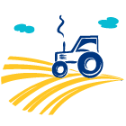 %
% %
% km
km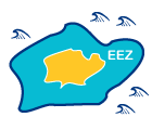 km2
km2 km
km


 Total %
 persons per km2
 Child:


 Exports: %
 Exports: %